S&F Hero: Military Art: The Suwałki Corridor as a Subject of Self-Obfuscation: Part 3
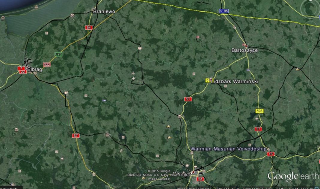
Figure 37: The Poles have garrisoned forces at Braniewo and Bartoszyce along the border of Kaliningrad Oblast, where their barracks and equipment are in range of Russian artillery. The Elblaski Kanal and the numerous small lakes between Elblag and Olsztyn are the only operational-scale defensive line between Kaliningrad border and the Vistula River. North of this line the terrain alternates between open and broken (See Figures 38 and 39).
On the Vistula arm of the encirclement, the initial operational objective would involve the cities of Elblag and Olsztyn and the barrier between the two cities formed by the S7/E77 highway, the Elblaski Kanal, and the numerous small lakes that run to within fifteen kilometers of the Vistula itself. To the north of this natural defensive terrain, the Poles have garrisoned forces at Bartoszyce and Braniewo, the headquarters of which would be immediate tactical objectives in any Russian offensive since they are fewer than 10 kilometers from the Kaliningrad border. (See Figure 37)
Figure 38: Broken terrain north of Dobre Miastro, approximately halfway between the Kaliningrad border and Olsztyn.
Figure 39: Open terrain approximately twenty kilometers north of Olsztyn.
The subsequent tactical objective would likely be the Nogat River line between the Baltic Coast and the Vistula River, and from that point south along the Vistula to Bydgoszcz, which will be necessary to protect the subsequent operational rear of Russian forces advancing in a southeasterly direction toward Warsaw.
The tactical objectives on this immediate operational axis of advance would include six bridges so as to prevent counterattack from Polish or other NATO forces from the West. The terrain between the Nogat and Vistula Rivers consists of rivers, canals, and swampy terrain that could become a “sink-hole” for troops sorely needed elsewhere, so for the Russians there is little need to accomplish more than control of the Route 7 and Route 22 bridges and the ferry over the Nogat.
While the Route 7 bridge over the Nogat (See Figure 40) could be destroyed easily, the three bridges (road, rail and pedestrian) located at Malbork present a more challenging task because the city lies on the right bank, thereby making the bridges easier to protect by defending forces (See Figure 41). This is not to preclude that the attacker wouldn’t seek to neutralize the Route 7 and Route 22 bridges and ferry over the Vistula River. It is simply important to understand that doing so would be unnecessary and pose a drain on limited resources.
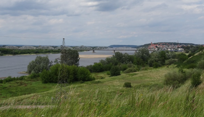
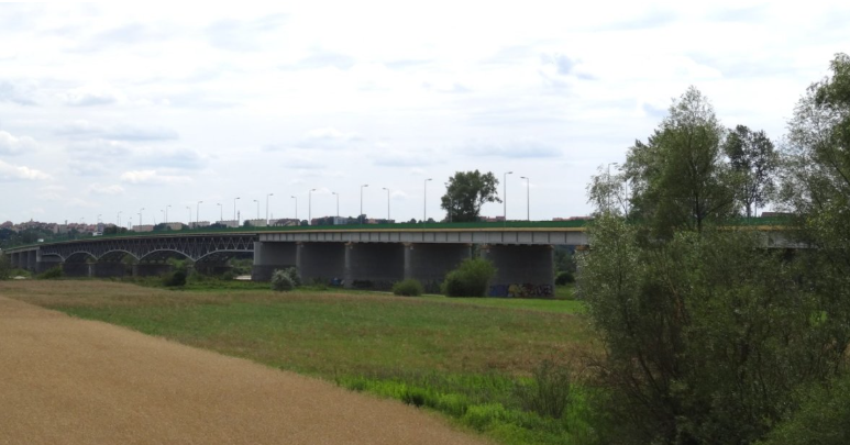
South of the confluence of the Nogat with the Vistula, the Russians would have to seize, or at least destroy, four crossing points over the Vistula before the river turns eastward toward Warsaw – at Kwidzyn (See Figure 42), Grudziadz (See Figure 43), Chelmno (See Figure 44), and at Bydgoszcz (See Figure 45). Only Grudziadz “shields” its bridge over the Vistula from an attack from East. However, since the city of Bydgoszcz would not be a critical objective, this tactical axes wouldn’t require extensive forces. Once the prepared West-East crossing points have been secured, not only the river lines themselves, but the North-South E75/A1 highway would constitute a contributing obstacle to mounting a West to East assault against the Vistula/Nogat river line.
Once the western flank of the axis of advance is secured, the subsequent operational objective would be the bridges over the Narew River. As Russian ground forces advance south-east from a line approximating Route 16 between Grudziadz and Ostróda, the right flank of the offensive will have to be secured by seizure of the bridges over the Vistula River. This would require not less than four tactical operations to seize Vistula river crossings along the subsequent operational axis of advance on this operational direction.
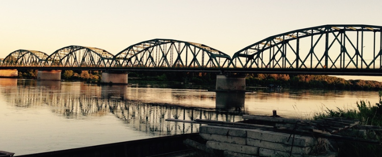
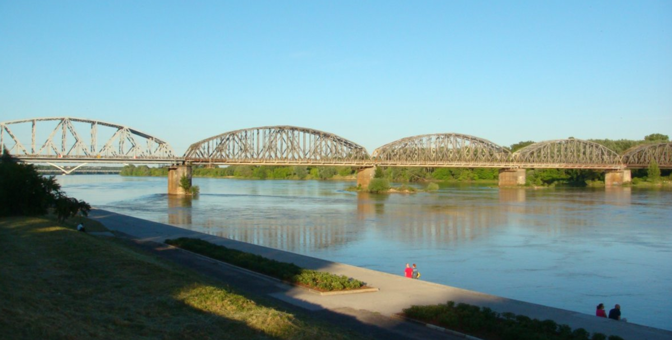
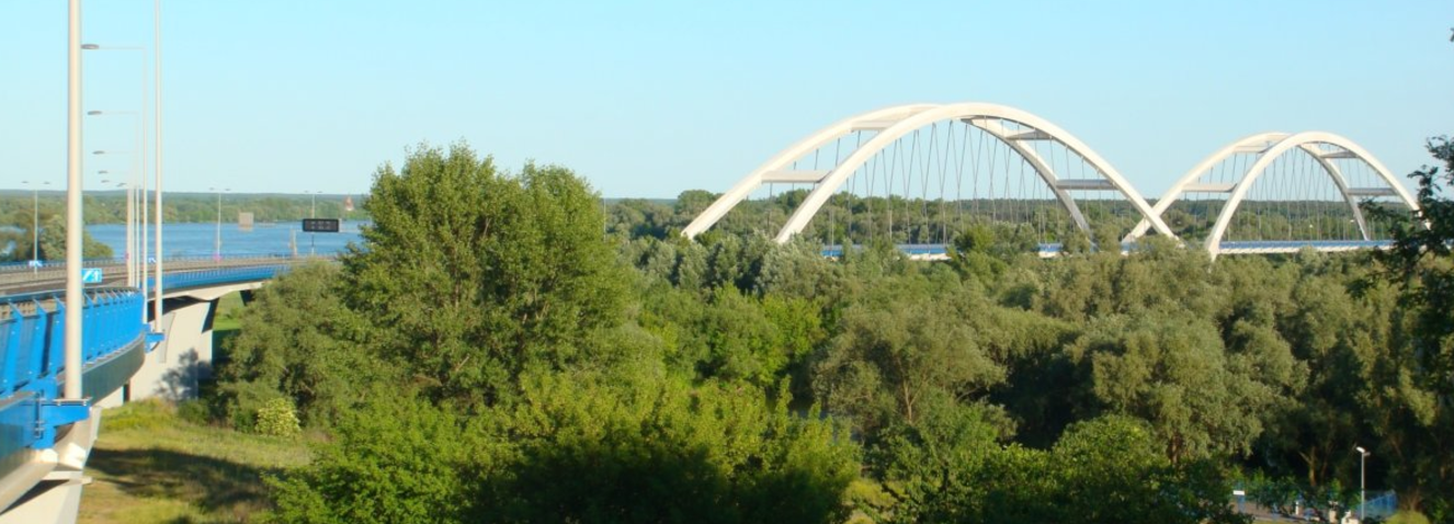
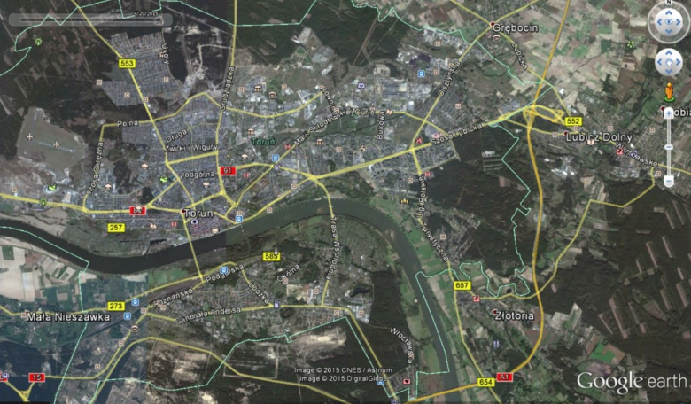
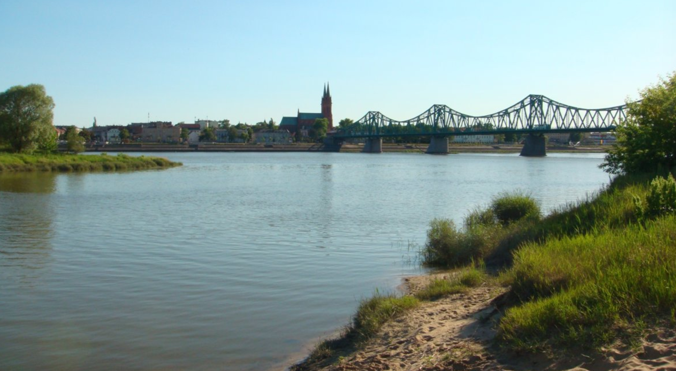
The first of these tactical axis, directed at Toruń, poses a particularly difficult challenge for a Russian operation because, except for the E75/A1 highway bridge over the Vistula that crosses the river southeast of Toruń, the other three bridges over the Vistula lay between the city and the river (See Figures 46-49). This means that unless the bridges are seized with air-mobile forces in envelopment, the city itself can be used to defend the bridges. Leaving the bridges in the control of Polish forces would mean providing a bridgehead for a counterattack into the flank and rear of Russian forces that would be ever more extended as the Russian offensive moves further Eastward toward Warsaw. Thus, not capturing Toruń might well require more forces to secure against a breakout by NATO forces from the city and a counterattack against Russian forces than would be required to fight into the city.
Figure 40: Route 7 between Elblag and Gdańsk over the Nogat River, ten kilometers west of Elblag
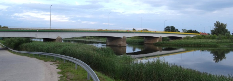
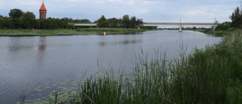
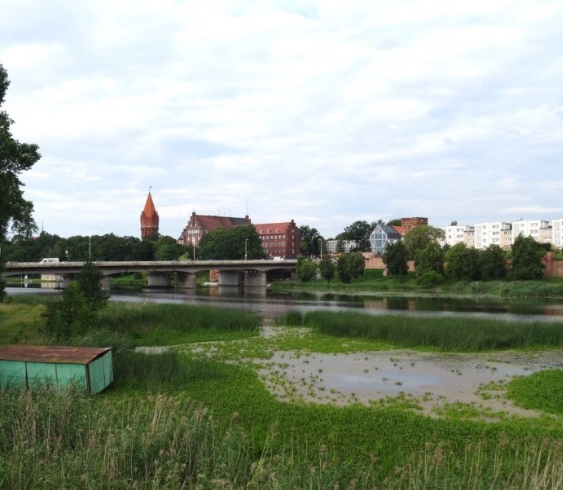
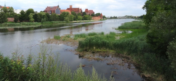
Figure 41: The three bridges over the Nogat River at Malbork include a road (Route 22 on lower left), a pedestrian bridge (seen in front of the rail bridge on the lower right), and a rail bridge (seen in the upper photograph). It is important to note that the three bridges over the Nogat which runs along the West side of the city, are especially defensible because the old Tutonic castle in the city could be turned into a fortress from which to defend the bridges. Thus, Malbork constitutes a potential bridgehead from which Polish or NATO forces could launch a counterattack deep in the rear of the Vistula arm of encirclement. As a result, Malbork must be captured or destroyed for a Russian encirclement operation to be successful.
Figure 43: Route 90 bridge over the Vistula River approximately eight kilometers West of Kwidzyn.
Figure 44: Road and rail bridge over the Vistula River at Grudziadz.
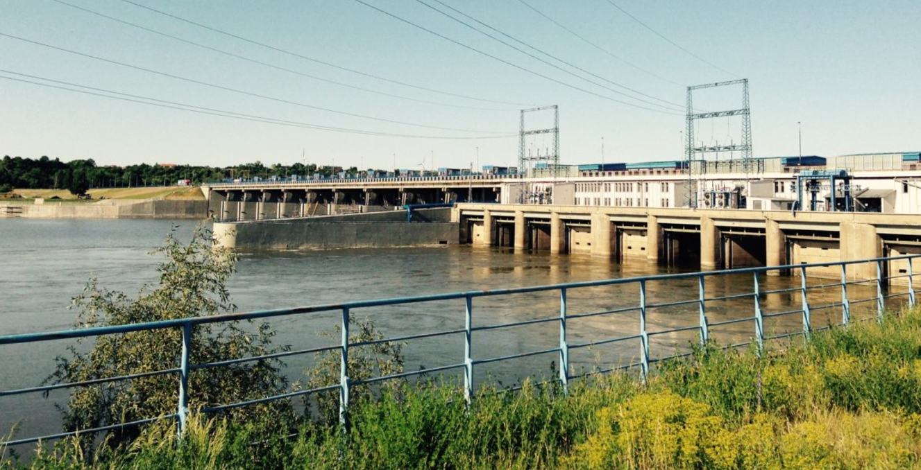
The second tactical axis, directed against Włocławek, would be difficult to defend because the city is on the left bank of the river which is significantly lower than is the right bank of the Vistula. Furthermore, the approaches to the bridge (See Figure 50) and over the dam on the Vistula at Włocławek (See Figure 51) are not particularly heavily forested terrain.
Figure 44: Route 91 bridge over the Vistula River three kilometers West of Chelmno.
Figure 45: This bridge across the Vistula River into Bydgoszcz would the final objective on this tactical axis designed to secure the right flank of the Vistula Operational Axis.
Figure 46: Western-most bridge in Torun city; photo taken from right bank, looking west.
Figure 47: Rail bridge in Torun city; phototaken from right bank, looking east.
Figure 48: Newest road bridge in Torun (population of 200,000), is the eastern-most bridge within the city.
Figure 49: The E75/A1 highway bridge is not screened from the north by the city of Toruń itself and, as a result, might have to be taken down to prevent a crossing by Russian forces that could threaten to encircle the city.
Figure 50: The city of Włocławek as seen from the right bank (north side) of the Vistula River.
Figure 51: The dam (with road across the top) just east of and upriver from Włocławek as seen from the left bank (south side) of the Vistula River. The woods that can be seen on the far side of the river in this photograph quickly gives way to open terrain.
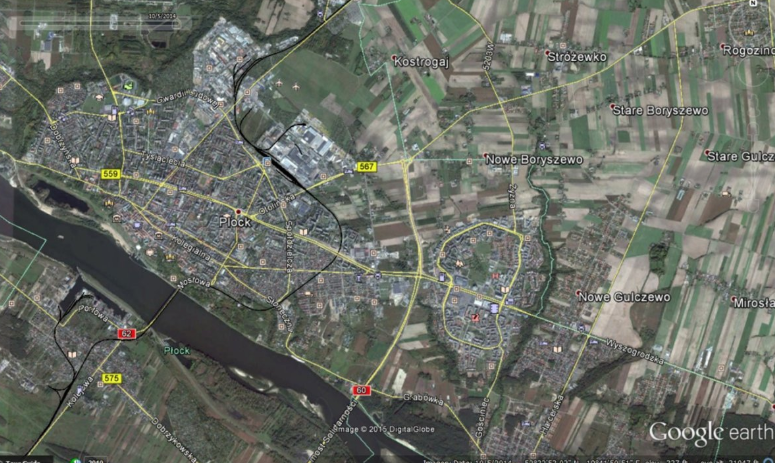
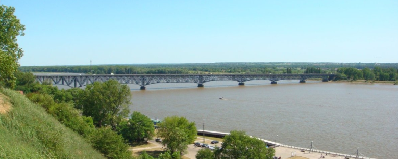
The third tactical axis would be directed against Płock, and much like at Toruń, the city itself can be turned into a bulwark in defense of the three bridges (note that rail and road beds transit across the same span) over the Vistula.
Leaving Płock in the hands of Polish forces would be even more dangerous than leaving Toruń in their control because of the extended lines of communication of a Russian advance at that point in the operation. Having secured the three bridges over the Vistula behind the city itself, Allied forces would have rail and road infrastructure to rapidly move forces and ammunition in support of a counterattack against the right flank of the Russian operational axis.
The city and its bridges would be a major Russian objective in any attempt to encircle Polish forces in the northwestern quadrant of the country and bring pressure on Warsaw to withdraw from the Alliance. Should the Poles and their allies be able to hold Płock and its bridges, there is little in the way of tactical barriers upon which Russian forces could organize a line of defense for the right flank of its advance toward the Narew River bridges (See Figures 52 and 53).
The fourth tactical axis is focused in the direction of Warsaw. It would have to cover a frontage of some 60-70 kilometers in order to seize the bridges over the Vistula between Wyszgrod and the confluence of the Narew and Bug Rivers. The Russian General Staff might view this axis as relatively easy because of an expectation that Polish forces would assume a defensive posture in front of the capital but behind the Vistula-Bug river line.
Figure 52: Built-up areas of Płock could be employed in the defense of the two spans (one carrying both road and rail) over the Vistula. Note the open farmland to the north and east of the city, which would provide ample opportunity for conducting a counter-offensive from the city.
Figure 53: This photograph provides a useful perspective on how much higher the terrain is on the north side (right bank on left in this photograph) at Płock. The city has a population of more than 125,000.
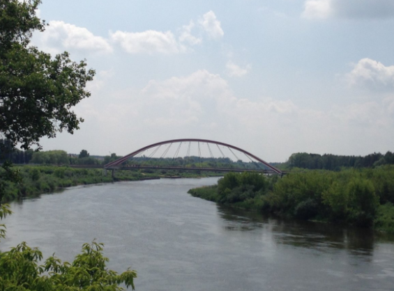
While the four tactical axes described above would secure the flank of the operation, the operation itself would not be directed at capturing Warsaw. The goal of this arm of the operation would be to close the encirclement on the Narew River. In addition to the bridge over the Narew River near its confluence with the Bug River, seizing bridges at Pułtusk and Różan probably would be objectives for the forces of this arm of the encirclement (See Figure 54). The bridges further upriver would most likely be assigned to be seized from the forces operating on the Bug River arm of encirclement (See Figure 55).
Figure 54: Bridges over the Narew River at Ostrołęka. The photographs of both the new (left) and old (right) bridges provide an accurate impression of the challenges of a forced river crossing presented by the swampy banks of the Narew River.
THE IRON TRIANGLE – HOLDING WARSAW HOSTAGE
Having closed the operational-strategic encirclement along the Narew River, only one task would remain – placing the Polish capital of Warsaw under direct siege. To tighten the political grip on Poland by threatening an armed assault on Warsaw itself, the Russian General Staff would need to seize the five bridges over the Vistula-Narew-Bug River line running some 20-30 kilometers to the north of the city center. Doing so would also place the new Warsaw airport in the hands of the Russians. Closing the operational-strategic encirclement along the Narew River would deny the government control over approximately onequarter of Polish territory, hold hostage a sizeable portion of the Polish Army, and place the Polish capital of Warsaw within range of Russian artillery.
Apologists for Russian behavior, as well as those who believe that aggressors can be deterred with empty words, will undoubtedly argue that all that has appeared in the paragraphs that proceeded this one is nothing more than the fearmongering of an Old Cold Warrior. During the next military parade in Red Square take a look at those sitting on top of the Lenin Mausoleum, and that is exactly what will be observed: a corrupt political elite that perceives the collapse of the Soviet Union as a great tragedy, and a military elite committed to the conduct of offensive ground operations. The current obsession with defense of the Suwałki Gap/Corridor is confusing serious operational-strategic thinking in the West.
There is a single almost 1,ooo kilometer-long land line of communication (LOC) that has a particularly narrow “choke point” that is possible to close with artillery fire. The solution is to “think bigger” than the defense of the choke point on this LOC, since any attempt to defend it with “boots on the ground” would be squandering valuable resources by “putting them in harm’s way.”
The Baltic States are defensible, but up along their borders with Russia; and depth of the theater of operations must come in the form of defense of the Estonian Archipelago and the transformation of the Baltic Sea into a “European Lake.”
The Poles like to say that to deter Moscow, the Kremlin must understand that there will be no small wars with European Union and NATO Members; that war will mean the loss of Kaliningrad Oblast, the destruction of the Russian Army, and probably regime-change in Moscow (although not necessarily one imposed by NATO force of arms).
NATO commanders must know now that there will be no restrictions on counter-battery fire; and the Russians that artillery fire out of Kaliningrad will be suppressed by fire.
A ground attack into Lithuania must not just be met by the defense of Lithuanian territory, but with the liberation of Kaliningrad (and know that Western forces will be welcomed by crowds waving European Union flags). Any participation in Russian aggression against European Union or NATO Members – to include the use of its territory – by Belarus will mean the liberation of Belarus by force of arms. And NATO strategic infrastructure must reflect the reality that the European Union and NATO combat actions will only be in response to Russian aggression, hence significant capacity must of necessity be located behind the Vistula River, and out of the immediate operational-tactical zone of attack. Any Russian aggression will reflect strategic operations and must, therefore, be deterred with the same scale of military planning: the threat must be defined to reflect real Russian General Staff thinking in order to deter it with clear and unambiguous preparations.
Autor
Dr. Phillip A. Petersen
President of the New Generation Warfare Centre (NGWC). From October 1991 through the December 2017 at The Potomac Foundation. In this capacity, he co-authored the Baltic Security Net Assessment for the Baltic Defense College in Tartu, Estonia. The Baltic Security Net Assessment marked a culmination of Dr. Petersen’s unique educational and career experience along with a determination to provide operational-strategic war-fighters with an operational-tactical guide on necessary demands to make from military intelligence resources. Having worked with Andrew Marshall during his time at the Defense Intelligence Agency and in the Office of the Secretary of Defense and having been taught the importance of terrain by German General and former Commander in Chief of Allied Forces Central Europe Franz-Joseph Schulze, Dr. Petersen was able to fuse terrain analysis of the Baltic States with the revolutionary wargaming work of Mr. Edmund Bitinas. The result produced a Baltic Security Net Assessment that focused on questions relevant to practical problem solving within NATO’s contemporary military infrastructure.
Having predicted the collapse of the Soviet Union, he came to Potomac in anticipation of conducting a three-year interview project on Security Policy in the Post-Soviet Republics. Visiting all fifteen of the former Soviet republics, fifteen of the regions of the Russian Federation, and interviewing over 400 senior officials, Dr. Petersen’s research was published in the Journal of European Security. Subsequently, as part of Potomac’s NATO Enlargement Initiative, Dr. Petersen conducted multiple tours for U.S. Congressional Staff Delegations to Eastern Europe to promote an increase in NATO membership.
Dr. Petersen’s received his Masters at Western Michigan University with his thesis on Systemic Adaptation: Can The Soviet System Accommodate The "Democratic Movement"? He later received his Ph.D. from the University of Illinois with his dissertation on Images As Defense Policy Determinants In The Soviet-American Military Relationship Since 1945. Dr. Petersen served for fifteen years as a United States Army officer, as an intelligence analyst for the Defense Intelligence Agency, and as a policy analyst in the Office of the Secretary of Defense and at the National Defense University. He has authored some eighty publications on international security issues, believing that it is the responsibility of each generation to insure that the next generation is sufficiently educated on the errors of the past to make its own, original mistakes.




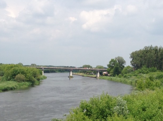




Trwa ładowanie...