Smolensk Gate and the Golan Heights
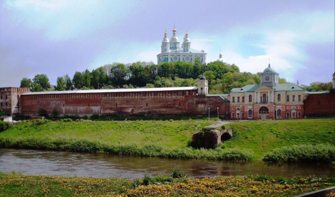
Dniepr river in Smolensk, Russia (photo: Wikipedia)
Their common feature is the vastness and spatiality, which – due to the relative weakness of the forces earmarked to defend and secure all the areas – it will never be possible to control evenly.
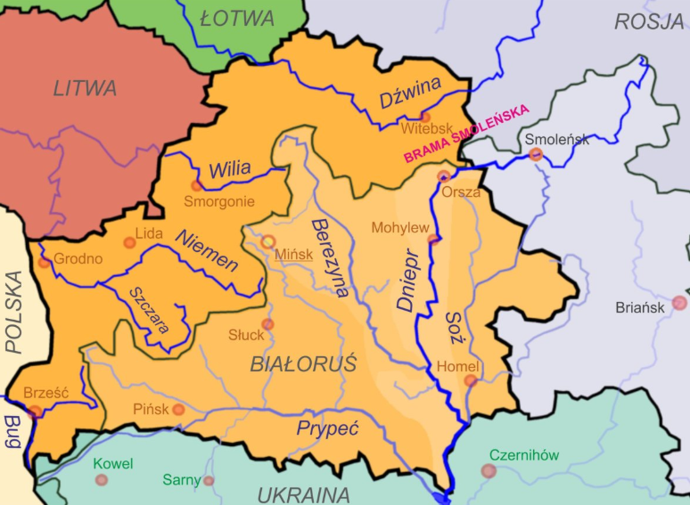
The Baltic direction behind the Suwalki Gap has recently been discussed in Strategy&Future (in three parts). The most dangerous, the north direction (also known as the Belarusian), stretching from Polesie to the Daugava, and bounded by the Niemen in the west), is located in the Belarusian highland. It is an open, a bit rolling terrain that gives relatively good observation conditions. Apart from the upper Niemen and the Szczara and the swampy valleys of these rivers – it does not contain any major terrain obstacles. Herein lies the shortest and the most convenient routes of the Russian invasion of Poland, originating in Smolensk, Orsha and Vitebsk, i.e. the central base of the Russian empire.
The Russian offensive movement on relatively numerous and good roads here separates Poland from the Baltic states and ports and restores Russia’s land connection with Kaliningrad, facilitating the supply of the Russian army in this region.
By projecting power across the Belarusian front from the Smolensk Gate, the Russians can force the entire Polish front into retreat and move the war – as has happened many times in history – to the central Vistula valley, and therefore to the heart of the Poland, thus paralysing the main centres of its political will and compromising Poland’s defensive posture.
The entrance gate from the Polish core area towards the Smolensk Gate stems from the arrangement of lakes, rivers, forests and lowland areas of north-eastern Poland. The Suwałki Gap is the area between the Niemen river and the Kaliningrad Oblast, formerly the Prussian border, with numerous lakes stretching from the north to the south, the largest of which are around Augustów and near the Augustów Canal system. From Suwałki, along the border to the south, there is a muddy stretch – the great Augustów Primeval Forest (Puszcza Białowieska). Further towards Lithuania, the Suwałki Gap transforms into a series of smaller, but frequently located hills, stretching beyond the current Lithuanian border to Marijampole, creating an ideal place for a tank battle in an area convenient for tanks. There, this area joins the forests descending into Kaunas.
It is difficult to concentrate troops in the Suwałki Gap. Augustów occupies the most important location, closely barring free communication in this area, and the city cannot be simply bypassed in the event of hostilities. In addition, its location and topography are great for turning it into a fortress barring in the process all the opponent’s movement.
In its military history, Poland entered the main entrance between Białystok and Wołkowysk to the Belarusian theatre of war operations and then to the Smolensk Gate and crossed the Daugava river along the old Polish warfare trail, in the narrowest passage between the muds of the Biebrza and the Narew and the Białowieża Forest. Then the trail continued from Baranowicze) to Mińsk, and the northern passage from Lida) through Wilejka to Połock or straight from Vilnius to Połock – on the upper hinge of the Smoleńsk Gate.
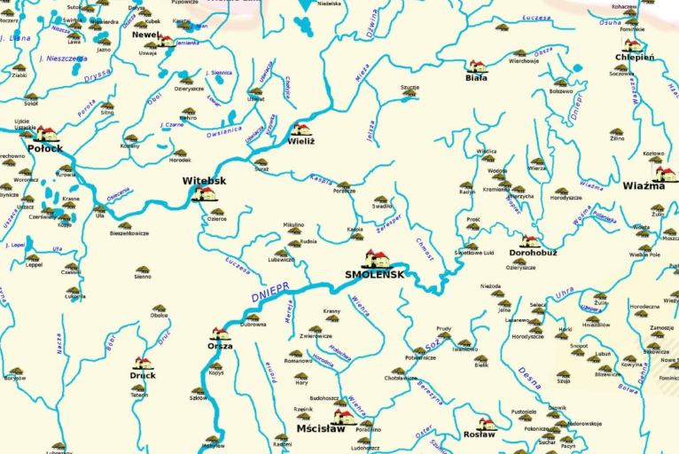
The gap between the upper Dnieper and the Daugava, forming the Smolensk Gate, is about 80 kilometers wide and it is a lowland plain covered with only scarce forests and cut through by minor two rivers, and in one third of the width partitioned with an area of mudflats – known in Polish as Błota Weretejskie – 25 km long and 15 km wide.
Smolensk Gate (photo: Wikipedia)
The areas next to the Daugava and the Dnieper rivers are convenient for large force maneuvering. Of the rivers crossing the Gate, the only significant ones (each of them is about 20 m wide) are the Łuczosa and the Kaspla. The Łuczosa, also known in its upper reaches as the Werchita), originates northeast of Orsha near the Dnieper and crosses the Smolensk Gate flowing almost along the entire width of the banks of mostly rugged terrain. The Kaspla, in turn, flows in a general direction to the north-west, into the Daugava River near Suraż. Both rivers can become only a tactical obstacle, at most, and only during heavy floods. In front of the Smoleńsk Gate from the west direction at a distance of 90-120 kilometers – there is a group of Lepelskie Lakes, channeling traffic towards the Berezyna fords near Borisov. The muddy Berezyna valley “closes” access to the Gate. The area around Lepiel is a great crossroads from which natural routes lead to Moscow – one south passing the Dnieper on the right – to Wiaźma through the Smolensk Gate and the other north through Vitebsk and along the banks of the Daugava to Rżew).
The military significance of this great road leading to Moscow is magnified by the fact that there are three major cities along the route: Mińsk, Vitebsk and Smoleńsk. Only Gomel lies slightly off the beaten path of this route. The Smoleńsk Gate traditionally shielded the heartland of Russia from the Polish Empire in the past and protected the capital of the tsars, only 480 kilometers away – Moscow.
One can compare the significance of the Smolensk Gate for Poland and Russia to the importance of the Golan Heights for both Israel and Syria.
If Golan is characteristically raised above the neighboring areas of Israel, then the core areas of Israel in Galilee, including Lake Galilee, Tiberias and the Jordan Valley, and even the Valley of Gilboa, are relatively safe from threats emanating from Syria or from any powers using the Syrian territory to initiate attacks against Israel. On the other hand – if the Golan Heights are in the hands of the Israeli army, then the Syrian capital, located less than 50 kilometers from the eastern edge of the Golan- Damascus – is within the direct Israeli military reach from the commanding Golan Heights, from a convenient operational base, including a potentially rapid land offensive going down through Quneitra to Damascus. This would be a strategic nightmare for Damascus.
If Syria, in turn, had Golan Heights in its possession – as it was before the 1967 war – then the Israeli core area could not develop properly (settlements and kibbutzim in Galilee located near the Golan Heights were before 1967 constantly disturbed by Syrian military activities), and in the event of a symmetrical war and a land invasion, the immediate danger of seizure threatened the entire Israeli area from the border with Lebanon, through Galilee, to the border with Jordan and the Gilboa valley, from where it is not so far to Tel Aviv or the Mediterranean coast.
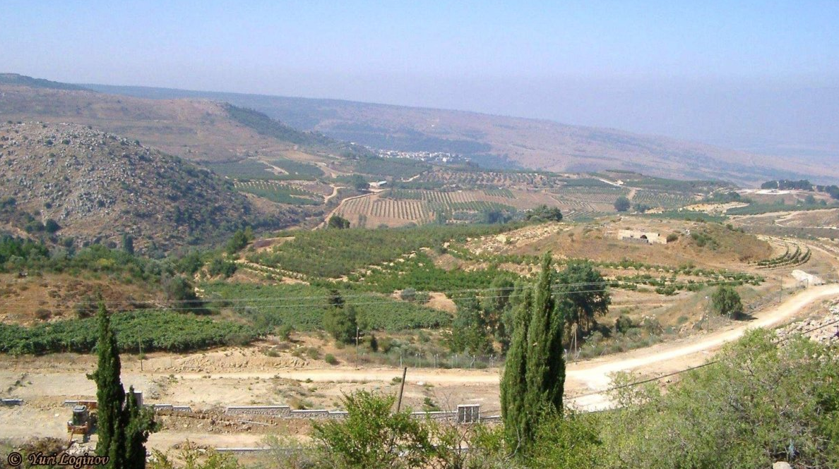
Golan Heights, Israel (Photo: Yuri Loginov, Pexels)
This was clearly seen during the Yom Kippur War in 1973, which the Arabs called the Ramadan War. The Israeli army was surprised at the same time on the Egyptian and Syrian fronts and did not have sufficient forces to prevent the Syrian armored forces from overflowing through southern Golan, which threatened the Syrians to quickly seize Degania and Tiberias on the shores of Lake Galilee.
In fact, it also resulted in the evacuation of people deeper into Israel. Literally at the last minute, the offensive (aimed at breaking the defense of the southern Golan Heights and then rolling down the slopes of the western plateau straight into the heart of Israel through the efforts of Israeli reservists entering the war) was halted by brave Israeli reservists.
It is also enough to imagine what the situation would be from the point of view of Israel’s interest if the Golan Heights returned to Syria as a result of peace talks several years ago. Today, as in all of Syria, there would be a civil war there, which would mean automatic destabilization spreading out of the Golan into Israel’s core region. In particular, if – as Israeli representatives often say – Iran, hostile to Israel, became the dominant power in war-torn Syria.
The above example clearly shows the importance of strategic buffer zones and that this is not a theoretical issue or known only from the annals of history. The prosperity and security of other areas depends on the safety cushion offered by such buffer zones.
To the east behind the Smolensk Gate, the country becomes hillier and drier up to the central part of the Russian Upland. In front of the Gate from the west, the area around Lepiel abounds in lakes, which creates an obstacle to driving deep into the Smolensk Gate from the Polish side. A larger lake group is also located on the left bank of the Daugava River between Połock and Bieszenkowicze). This is a convenient point to defend the wing of this Gate among the few hills loosely scattered, with gentle slopes and a wavy horizon, in an area ideal for tank war.
The Dnieper from Orsza flows through a wide valley with abundant spring floods, numerous oxbow lakes, lakes and the roads through them traditionally led to dikes. In contrast to the Vistula, which is not always suitable for fording, it was possible to ford the Dnieper during the dry run up to the mouth of Berezyna. The Berezyna to the mouth of Hajna flows within the muddy banks overgrown with bushes, with a small number of places to descend and ford, making it is difficult to cross, with a convenient crossing point at Borysów – known thanks to the legend of the retreat of the Grand Armée in the autumn and winter of 1812.
Forests stretched along the river, difficult to pass, becoming wider to the south, increasing the importance of this river as a defensive line. The Lower Pripyat has no fords at all. By contrast, the Daugava River has quite a lot of them for a change.
It is interesting – as described by Władysław Sikorski in his memories of the 1920 war – that as a result of the success in the war of 1919–1921, some Poles ‘dreamed’ of the same eastern borders as before the Andruszów truce of the 17th century. Going in this way even further beyond the strategic defensive line of the Daugava and Dnieper rivers and reaching as far as Wielki Łuki, Wiaźma, Bryansk or Poltava deeper into Russia proper thus consolidating forward defensive areas additionally screening the great rivers’ line that were a traditional boundary between the Polish and Russian worlds and former empires. Others, however, considered the minimum plan to be at least the old borders of the former Polish-Lithuanian Commonwealth before the First Partition.
As part of the Revolution in Military Affairs (RMA), the center of gravity in this region is becoming the growing competition for situational awareness advantage in the modern scouting battle to be waged throughout the Baltic-Black Sea bridge.
Poland connects the Atlantic oriented Europe with the entire eastern front facing Russia and stretching from the Black Sea to the Baltic Seas. Therefore, it has the main communicating role. In geopolitical terms – Poland is a key pivot.
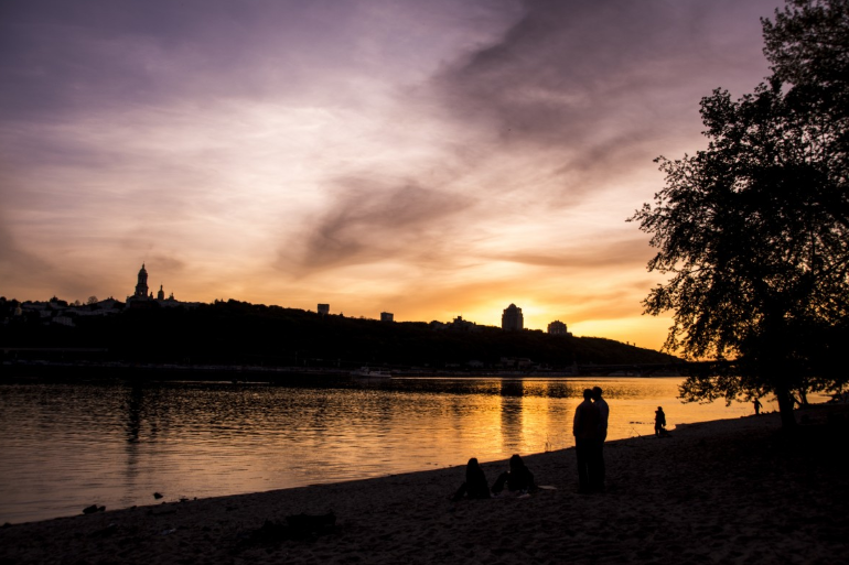
Dnieper river in Kyiv (photo: Pxhere)
Poland is coming to understand continuity of importance of the former strategic borders of the former Polish-Lithuanian Commonwealth that is stemming from the ruthless logic of the Smoleńsk Gate, from which the rapid maneuver of the enemy towards the Vistula valley threatens Poland’s existence.
At Strategy&Future we promise to continue to reflect on the considerations of the previous centuries and of the great leaders of the Intermarium from the past as these are growingly valid today in the new strategic landscape.
Autor
Jacek Bartosiak
CEO and Founder of Strategy&Future, author of bestselling books.




Trwa ładowanie...